
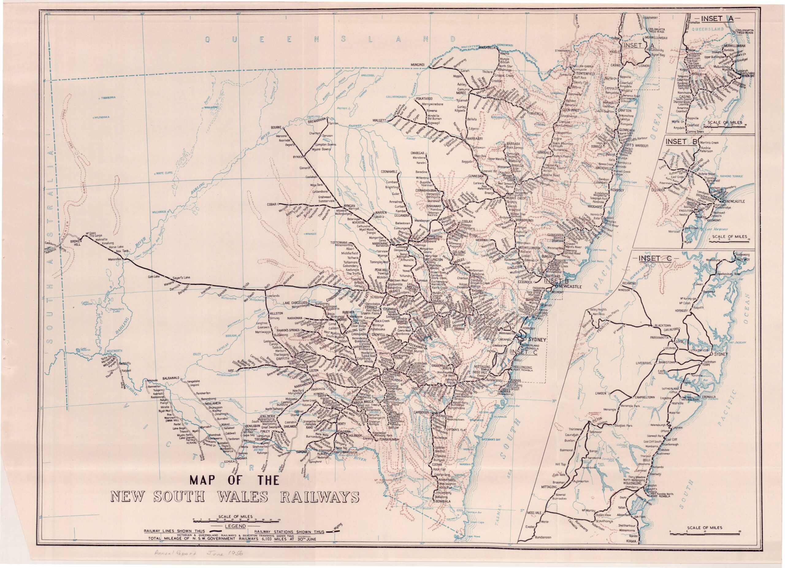
Description
Map of the NSW Rail Network in 1956. This was close to the peak of the rail network and shows the location of branchlines and junctions throughout NSW. As shown in the 1956 NSWGR Annual Report.
Reproduced on quality paper, A1 size (594mm x 841mm) and shipped in sealed postal tube
![Steam Power's Record Run - 3801 [Large]](https://arhsnsw.com.au/wp-content/uploads/2024/08/Steam-Powers-Record-Run-3801-pdf.jpg)
![Essington Lewis - 520 Class Print [Small]](https://arhsnsw.com.au/wp-content/uploads/2025/11/Essington-Lewis-520-Class-150x117.jpg)
![Symphony in Blue - Spirit of Progress [Small]](https://arhsnsw.com.au/wp-content/uploads/2024/10/Symphony-in-Blue-Spirit-of-Progress-pdf.jpg)
![Dawn Of A New Era - Waratah A Series [Large]](https://arhsnsw.com.au/wp-content/uploads/2024/08/Dawn-of-a-New-Era-Waratah-A-Series-pdf.jpg)